


SIERRA HELADA NATURAL PARK
Explore the natural park and climb the 7 peaks of the Sierra Helada, a mountain range which separates Albir from Benidorm.
SIERRA HELADA NATURAL PARK
Explore the natural park and climb the 7 peaks of the Sierra Helada, a mountain range which separates Albir from Benidorm.


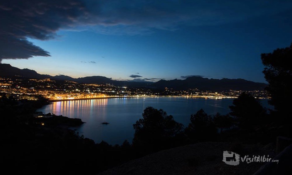
The magnificent Sierra Helada mountain range provides a beautiful backdrop for the wonderful seaside resort of Albir and separates the town from its larger neighbour, Benidorm.
Set in a natural park with more than 5,600 hectares, this now forms part of a larger, highly protected nature reserve, the first maritime land park in the Valencian Community.
Nature and history intertwined
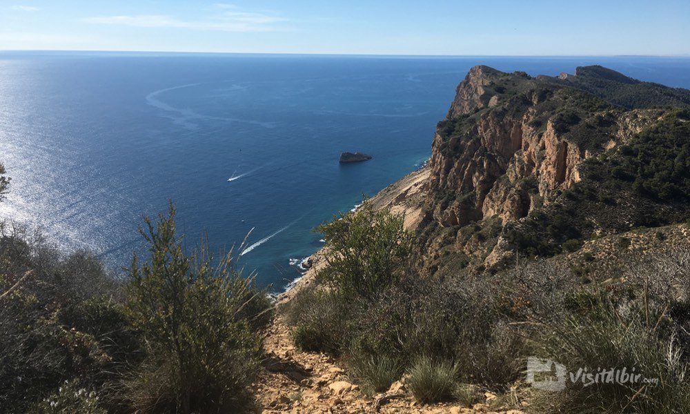
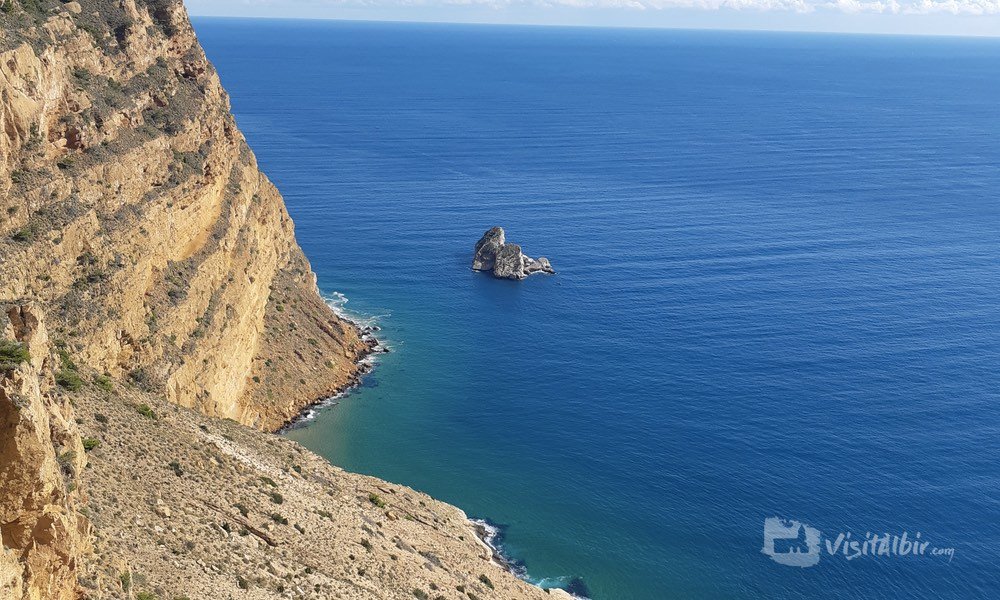
The park is renowned for hanging fossil dunes, caves and old ocre mines and much of the terrain has a distinctive red hue; there are also many beautiful coves and bays which are almost inaccessible by foot and have to be reached by boat or kayak.
“The Sierra Helada mountain range gives Albir a protective hug and a special microclimate”
There is a pretty white lighthouse at the end of the park along a gentle walk (see below) and lots of viewing platforms, picnic areas or places to sit and take a rest.
Check out Walking routes further below
Flora and fauna
The natural landscape is beautiful, with a wide range of fauna and flora, which help to maintain and protect the birds, insects and animals, which co-inhabit this special place. The turquoise blue waters contrast perfectly with the natural stone and the numerous pine trees give plenty of shading as you explore the park.
Under the waves
This is a diver’s dream, most of the protected area of the Sierra Helada natural park is underwater, in fact, there are vast tracts of underwater Poseiden grass which are essential for creating oxygen and food for a whole range of marine life. If you go diving take care not to damage anything or remove plants or animals from their natural home; boats should only be anchored to special eco buoys, which protect the environment.
“The views from the top of the Sierra Helada mountain range are simply stunning”
The Sierra Helada range
The 439 metre high mountain is more than one million years old and is known as the Sierra Helada, (Frozen Mountain) because the northern surface of the rock gets very slippery with the early morning mist.
Actually, it hardly ever freezes here, the mountain range around Albir provide a ‘protective hug” and a special microclimate which often keeps out the bad weather.
There is a staffed visitor centre at the entrance and car park; there are clearly signposted walkways and a range of different hiking treks, catering for all levels of fitness and health. This is also the starting place for a walk to the Albir lighthouse.
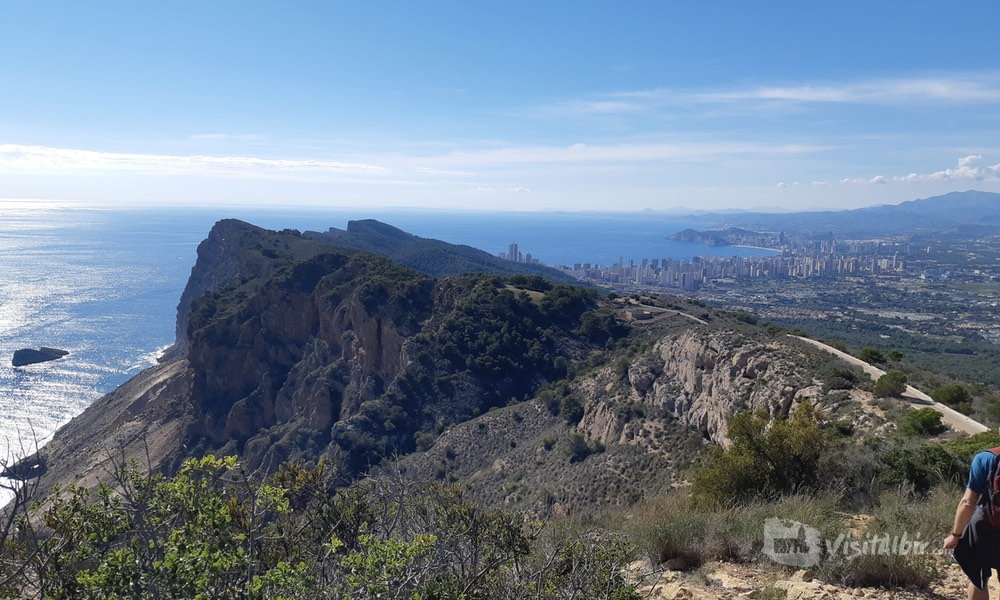
The climb to the top of the mountain is well-signposted although steep. Your effort will be rewarded by a wonderful view of the coastline and Bay of Altea to the north and the city of Benidorm to the south west.
How to get to the Sierra Helada
From the anchor monument at the centre of Albir, take the high road above (next to Bar Kazbrane) -this is a shared bike lane so proceed with care -follow this road up for about 600 metres and you will see the entrance to the free car park and visitor centre where there are also toilet facilities.
Walking routes:
Walk 1: The Lighthouse walk
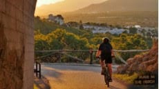
The most popular walk is along the tarmac road from the Visitor centre to the Light house (see separate section) Walk or cycle, dogs on leads.
Statistics
- Distance approx 4.5 km round trip
- Easy/moderate terrain
- Approx time 1 hour
How to get to the Lighthouse walk. From the centre of Albir, take the road above the anchor monument(alongside the Bar Kazbrane). Follow the road up the hill, be careful of cyclists coming downhill) and after about 600 metres, you will see the entrance to the Natural park car park. The lighthouse is at the end of a reasonably flat but windy road, just under2.5km each way.
Walk 2: The climb to the antennae
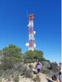
This is more of an “off piste” adventure, although still following clearly sign posted pathways. At times it is quite steep, and sometimes the path is less steady with loose stones and the occasional boulder, so it is not recommended for the elderly or those with mobility problems. Reaching the top of the mountain takes about 45 minutes, although you are rewarded with the most stunning views, including breath – taking cliffs and rock formations, an impressive aerial view of Albir
Statistics
- Distance 7 Km round trip
- Moderately difficult (some scrambling and steep ascents.)
- Allow 2 hours min
How to get to the antennae walk – From the visitor centre/ entrance to the natural park, start the main walk, passing the picnic area. Just at the next bend there is a large map and the trail starts uphill to the right of the board. Follow the signs, you will see the antennae on the mountain top as you approach.
Walk 3: The 7 Peaks of the Sierra Helada
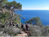
This is the most challenging walk of the Sierra Helada natural park as the walk passes along the seven peaks between Benidorm and Albir. You can walk in either direction, but remember to arrange transport at the other end as it is one way. The panoramic views are breath-taking, and well worth all the climbing up and down.This is only recommended for people with moderately high fitness levels and full mobility.
Statistics
- Distance 11km one-way trip
- Moderately difficult, but worth the challenge!
- Allow 4.5 hours
How to get to the Sierra Helada mountain walk – From Albir, the walk starts at the Sierra Gelada visitor centre and follows the initial route to the antennae (as above). There is then a marked pathway up and down seven peaks, before arriving at the Cross in Benidorm. Many walkers prefer to get a lift to the Cross and then follow the trail back to Albir.